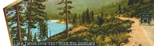
North Lake Tahoe Quiet & Easygoing
North Lake Tahoe is one of those places that invites your imagination in the moment you arrive. The air feels cleaner, the lake looks impossibly blue, and the mountains seem to lean in and say, "Welcome, you are going to like it here." This is the quieter, more easygoing side of Tahoe. Here you will find friendly towns, long beaches, ski resorts tucked into the mountains, and that classic "I could live here" feeling that sneaks up on people.
Best Travel Packs & Daypacks
Headed for the North Shore? A great adventure starts with the right pack. Whether you're wandering Tahoe City's lakeside paths or climbing up to a lookout above the water, a compact, durable daypack keeps your essentials close without slowing you down. Lightweight, rugged, and ready for anything, just like Tahoe itself. Our favorites are always by High Sierra bags. View Tahoe's best choices in bags and backpacks.
Incline Village, Kings Beach & Tahoe City
As you follow the shoreline going counter clockwise around the lake, you pass through Incline Village in Nevada, then Kings Beach and Tahoe City in California. Each town has its own personality. Incline Village feels polished and peaceful. Kings Beach is sunny, sandy, and full of energy. Tahoe City mixes mountain-town charm with lakefront views.
Tourism keeps the North Shore lively. Winter brings skiers and snowboarders chasing fresh snow. Summer brings beach towels, kayaks, and the sweet fragrance of sunscreen. Local shops, restaurants, marinas, and small businesses give the area its friendly, down-to-earth character.
A Quick Stop in Tahoe City
Sunnyside and Tahoe City sit along the northwest shore, right where the Truckee River begins its journey toward Reno. The coordinates (39.14324 N, -120.153525 W) put you right in the middle of classic North Shore scenery. Stop for a visit to walk along the top of the dam, to view this wonder.
Nearby communities like Dollar Point, Tahoe Vista, Carnelian Bay, and Homewood each add their own flavor. Some are quiet and woodsy. Others are lively and beachy. Together, they make North Lake Tahoe feel like a collection of friendly neighborhoods wrapped around a world-class lake.
North Lake Tahoe Demographics and Regional Personality
North Lake Tahoe covers the upper portion of the Tahoe Basin and is home to about 36 percent of the region's population. Compared to the south, the North Shore feels more relaxed and residential. It is the kind of place where people come for a weekend and end up browsing real estate listings "just to see what is out there."
Who Lives Here?
The population leans older, with many residents between ages 25 and 64, and a growing 65-plus community. Median age ranges from 42.2 to 60.9 depending on the town. It is a mix of long-time locals, outdoor-loving professionals, and retirees who decided they would rather spend their days near the lake.
Homes and Neighborhoods
North Lake Tahoe includes roughly 1,090 to 1,372 households, with an average household size of 2.0 to 2.38 people. Neighborhoods are spread out, giving the area a peaceful, open feel that is perfect for morning walks, stargazing, or simply enjoying the quiet.
Income and Local Economy
Average individual income is around $71,499. Tourism and outdoor recreation drive much of the local economy, supported by restaurants, retail, marinas, ski resorts, and small businesses. Incline Village is known for its high-end homes and attracts many high-net-worth residents who enjoy mountain living with Nevada tax advantages.
Community Makeup
The region is about 82 percent White, with a Hispanic or Latino population of about 16 percent. Seasonal workers, second-home owners, and visitors add to the area's lively, ever-changing rhythm.
Comparing North & South
South Lake Tahoe has the bigger nightlife and casino scene at Tahoe, but the North Shore is the place for people who want a calmer, more local feel. Think cozy cafes, long beaches, and mountain sunsets that make you forget what day it is. Although you will not find the glitz of a casino corridor, the North Shore offers nearby attractions to visitors, both in the water and out.
Interesting Stats About North Lake Tahoe
-
Country: United States
States: California and Nevada
Land Area:
- Region-wide Total (Lake Tahoe Basin): 501 sq mi (1,298 km2)
- North Tahoe represents approx. 36 percent of the region
- Approx. Land Share: ~180 sq mi (466 km2)
Elevation: ~6,200 ft (1,890 m)
Population:
- Total (North Tahoe communities): approx. 20,100 residents
- Share of Tahoe Basin population: 36 percent
Time zone: Pacific (PDT) (UTC-8)
- Summer (DST): PDT (UTC-7)
ZIP codes: 96140, 96141, 96143, 96145, 96148
Area code(s): 530 (CA side), 775 (NV side)
North Lake Tahoe includes communities along the northern and northeastern shores of Lake Tahoe, spanning both California and Nevada.
Take a Piece of Tahoe Home

Planning your trip is just the start. Remember to grab a keepsake to remember the magic of the High Sierra! We've curated a special collection of our favorite local finds, from cozy mountain apparel to unique handcrafted maps. Whether you're looking for the perfect gift or a little something to brighten up your own home, swing by our souvenir shop in Shop Tahoe and keep the spirit of Lake Tahoe alive.